25 of the Best Hikes Near Calgary, Alberta
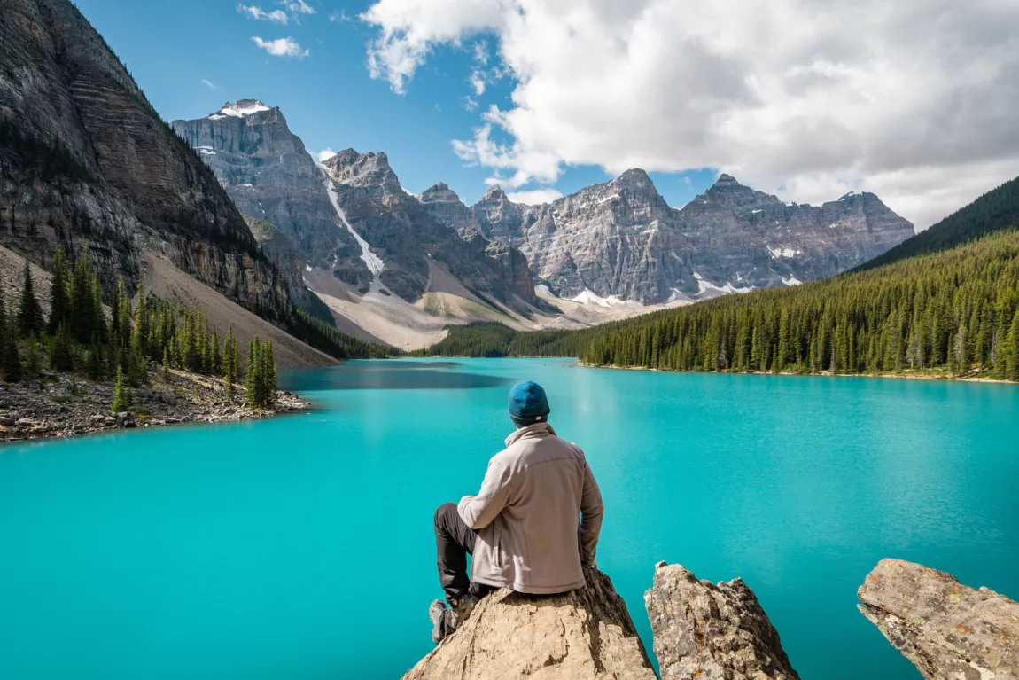
25 of the Best Hikes Near Calgary, Alberta

Calgary, Alberta is often called the gateway to the mountains—and for good reason. The drive within just an hour or two from the city, you’ll find some of the world’s most spectacular hiking trails, complete with jaw-dropping views that might just have you considering a move (if you don’t already call this place home).

While the city itself offers impressive green spaces—like the sprawling Nose Hill Park and Fish Creek Provincial Park—the real adventure begins just beyond city limits. The hikes featured here range from easy hikes to demanding alpine scrambles, from half-day outings to multi-day backcountry treks. They wind through breathtaking alpine terrain teeming with wildlife, seasonal wildflowers and those iconic mountain-and-lake vistas that define the Canadian Rockies.
Before setting out on any of these trails, please understand that they are all located in the backcountry. Be sure to thoroughly research your hike, dress appropriately (bring plenty of layers), leave a trip plan and pack the 10 essentials.
Tent Ridge, Kananaskis Country

Length: 10 km loop
Duration: 4-5 hours
Elevation Gain: 810 m
Difficulty: Hard
Tent Ridge Horseshoe is a must-do hike in Kananaskis Country, located in Spray Valley Provincial Park. Arrive early to beat the crowds and hike the loop clockwise to tackle the scramble section uphill rather than down. After a short, forested approach, the trail opens to the horseshoe-shaped ridgeline with incredible views of the Spray Lakes. Pause to catch your breath at the weather station before the final climb, then follow the ridge, with its panoramic mountain views, before descending back into the forest.
Distance from Calgary: 143 km
Park Pass Required? Yes
Skoki Loop Trail, Banff National Park

Length: 39.5 km loop
Duration: 10-12 hours or a four-day backpacking trip
Elevation Gain: 1500 m
Difficulty: Hard
The first four kilometres of this trail follow a fire road, but the stunning mountain and lake views of Skoki Valley make it worthwhile. The route begins with a gentle forested incline, leading to Hidden Lake, the first backcountry campsite. Continue to Boulder Pass for sweeping views of Ptarmigan Lake and Mount Fossil (an easy scramble). Follow the lakeshore, passing vibrant wildflowers in summer, and descend to Baker Lake, home to another campsite. From here, either head to Red Deer Lakes or veer west to Skoki Lodge and the nearby Merlin Meadows campground. If camping, consider a day hike to Merlin Lake and the Dragon’s Drink or tackle the short scramble up Skoki Mountain for panoramic views of the valley. To return, follow the trail to Deception Pass or Packers Pass, which offers views of two glacial lakes tucked beneath the striking rockface known as the Wall of Jericho.
Distance from Calgary: 178 km
Park Pass Required? Yes
Troll Falls, Kananaskis Country

Length: ~3 km loop
Duration: 1.5-2 hours
Elevation Gain: ~200 m
Difficulty: Easy
Troll Falls is a scenic, family-friendly hike year-round, but it truly shines in winter. Just beyond the initial falls, a short, steep detour leads to Marmot Falls (take the Upper Falls trail and watch for the first left-hand path). In cold months, the waterfall freezes over a rocky ledge, creating a magical scene where you can walk behind the icy curtain, offering a rare and safe taste of a winter wonderland. Microspikes are recommended if you plan to explore behind the falls or continue to the Upper Falls. The main trail to Troll Falls is wide and easy, with wooden play structures along the way that kids—and kids at heart—will enjoy. On your way back, consider looping through Hay Meadow for a peaceful and scenic finish.
Distance from Calgary: 98 km
Park Pass Required? Yes
Northover Ridge Loop Trail, Kananaskis Country
Length: 34 km loop
Duration: 10-12 hours or a three-day backpacking trip
Elevation Gain: 1,500 m
Difficulty: Extreme (route finding and scrambling involved)
Located in Peter Lougheed Provincial Park, Northover Ridge is one of the most spectacular and rewarding backpacking routes in Kananaskis, but it’s not for the faint of heart. This 34 kilometre loop (the ridge itself stretches almost three kilometres) winds through dramatic alpine scenery, with steep climbs, high ridgelines and views that stretch from glacial lakes to jagged peaks along the Alberta–BC border.
Starting at the North Interlakes trailhead, most hikers tackle it clockwise to climb the ridge rather than descend it. The highlight is walking the narrow, exposed ridge itself, an unforgettable experience that feels like you’re walking on top of the world. Best hiked in late summer when the snow has melted, this adventure demands strong legs, a head for heights and solid route-finding skills. For experienced hikers, it’s a bucket-list classic in the Canadian Rockies.
There are two designated backcountry campsites along the route—Aster Lake and Three Isle Lake—with the option to wild camp at the tarns just across the border in BC.
Distance from Calgary: 140 km
Park Pass Required? Yes
Sarrail Ridge via Rawson Lake, Kananaskis Country

Length: 11.5 km return
Duration: 4-5 hours
Elevation Gain: 1,048 m
Difficulty: Hard
The trail to Rawson Lake is a rewarding hike on its own, but it’s elevated—literally and figuratively—by an unofficial path that continues around the lake and climbs steeply to Sarrail Ridge. Start at the Upper Kananaskis Lake parking lot and follow the Upper Lake Trail along the shoreline. About 1.5 kilometres in, take the clearly marked turnoff to Rawson Lake.
Gentle forest switchbacks lead to views of Mount Sarrail’s slopes. Take a break at the lake before tackling the steep, unmaintained ascent to the ridge, where some sections are aided by an old rope (use with caution). The effort pays off with extensive views of surrounding peaks and lakes. Retrace your steps to return.
Distance from Calgary: 140 km
Park Pass Required? Yes
Healy Pass, Banff National Park
Length: 21 km return
Duration: 5-8 hours
Elevation Gain: 890 m
Difficulty: Moderate
Beginning in the Sunshine Village Parking Lot, the trail climbs through thick forest for approximately 7.5 kilometres before giving way to an alpine meadow that teems with wildflowers in the summer and the golden hues of larches in the fall. Continue to the pass to enjoy expansive views of the surrounding peaks and Egypt Lake, a nice addition for keen hikers looking to add some distance or for those looking for a backcountry camping experience. Return the way you came.
Distance from Calgary: 143 km
Park Pass Required? Yes
Lake Agnes, Big Bee*is*e and Devil’s Thumb, Banff National Park

Length: 12 km return to Devil’s Thumb (3.5 km to Lake Agnes and 5 km to Big Bee*is*e one-way)
Duration: 4-5 hours
Elevation Gain: 880 m
Difficulty: Moderate (easy to Lake Agnes)
Don’t let the chaos of Lake Louise in summer deter you from this hike as once you pass Lake Agnes (which is well worth a visit itself), the crowds thin out and the views become truly spectacular. A wide, gently sloping trail leads to the historic Lake Agnes teahouse. After circling the lake, the path steeply switchbacks up to a fork: head left to the Big Bee*is*e for panoramic views of the Chateau, Lake Louis and the valley below, or right to reach Devil’s Thumb. A brief scramble and some mild exposures are the only challenges before you’re rewarded with views of both Lake Louise and Lake Agnes framed by towering peaks. You can retrace your steps from here or extend your hike by returning to the fork and continuing to the Plain of Six Glaciers teahouse.
Distance from Calgary: 187 km
Park Pass Required? Yes
Wasootch Ridge, Kananaskis Country
Length: 13 km return
Duration: 4-5 hours
Elevation Gain: 950 m
Difficulty: Moderate
Wasootch Ridge is a hike that just keeps delivering. After a short, steep initial climb, expansive views of the surrounding mountains and valleys unfold with each step. The ridge rolls along rocky slopes and through patches of light tree cover, offering constant visual rewards as it follows the edge of the river valley below. In dry conditions, it’s possible to scramble up to Wasootch Peak and loop back via the valley. Otherwise, simply turn around whenever you’re ready. This is an out-and-back trail that’s stunning every step of the way.
Distance from Calgary: 92 km
Park Pass Required? Yes
Smutwood Peak, Kananaskis Country

Length: 18 km return
Duration: 6-8 hours
Elevation Gain: 950 m
Difficulty: Hard
A long, wide approach trail leads past a waterfall and into a sweeping alpine meadow (be sure to carry bear spray, as grizzlies are known to frequent the area). From here, the trail climbs steadily to a pass where the first views of the stunning Birdwood Lakes come into sight. Take a moment to soak in the dramatic peaks that surround you before hiking past the lakes and beginning the ridgeline traverse. A well-worn path cuts through the scree, but the loose rock demands careful footing. The effort is more than worth it, with panoramic views of the lakes, Mount Birdwood and Mount Smuts. Retrace your steps to return.
Distance from Calgary: 142 km
Park Pass Required? Yes
Ha Ling and Miner’s Peak, Kananaskis Country

Length: 7.7 km return
Duration: 3-5 hours
Elevation Gain: 810 m
Difficulty: Hard
Ha Ling requires a steady climb along a well-maintained 3.5-kilometre trail that leads to a saddle with comprehensive views of the valley below and Grotto Mountain. Along the way, several scenic lookouts, like the bird’s-eye view of the Canmore Reservoir, offer perfect spots to catch your breath. From the saddle, intrepid hikers can continue another 400 metres over loose rock to reach the main ridgeline. For those looking to extend their hike, continue right of the saddle to reach Miner’s Peak via a short, narrow ridge. Note: this route, while a popular winter hike, does pass through avalanche terrain.
Distance from Calgary: 111 km
Park Pass Required? Yes
Prairie View/Yates Mountain via Jewel Pass, Kananaskis Country

Length: 11 km return (add another km for Yates Mountain)
Duration: 3-4 hours
Elevation Gain: 550 m (add another 150 m for Yates Mountain)
Difficulty: Easy to the first viewpoint, moderate up to the rocky outcropping and Yates Mountain
A favourite among locals, this beautiful area in Kananaskis is one of the top spots for a scenic hike. With a variety of trails suited to different energy levels and abilities, there’s something for everyone: from a relaxed walk around the lake to a more challenging hike up to a rocky outcrop. The wide trail gently switchbacks through the forest for about five kilometres, leading to a broad, open viewpoint that makes a perfect turnaround spot for those not looking to push farther. The final half kilometre is consistently steep and can be muddy, but the views are well worth the effort. Beyond this point, the trail to Yates Mountain is unmaintained, so hikers should proceed with caution. For those looking to extend their adventure, the Jewell Pass loop offers an alternate, forested route back to the lake via a small waterfall.
Distance from Calgary: 84 km
Park Pass Required? Yes
Chester Lake, Kananaskis Country
Length: 9 km return
Duration: 3-4 hours
Elevation Gain: 400 m
Difficulty: Easy
Steady forested switchbacks lead to a beautiful alpine meadow, where the trail winds gently toward Chester Lake, tucked beneath the slopes of Mount Chester. Take time to explore the lakeshore and the nearby “Elephant Rocks,” a cluster of large boulders just beyond the lake. This popular trail is subject to a seasonal spring closure and is also a favourite for snowshoeing and cross-country skiing in the colder months.
Distance from Calgary: 147 km
Park Pass Required? Yes
East End of Rundle, Kananaskis Country

Length: 4.8 km return
Duration: 4-5 hours
Elevation Gain: 820 m
Difficulty: Hard
As one of the most popular hikes near Canmore, an early start is essential here. This moderate scramble follows the Rundle Ridgeline, which stretches between Banff and Canmore and includes 12 distinct peaks with EEOR (East End of Rundle) being the easternmost summit. The trail begins with a series of forested switchbacks, offering occasional views of Ha Ling Peak and the Canmore Reservoir through the trees. Once above the treeline, some route finding is required. A steep scramble through a rock band demands careful footing, and rockfall is a risk (consider bringing a helmet, especially on busy days). Skirt a large rock slab to the left to reach the summit, where panoramic views of Spray Lakes Valley and Canmore await.
Distance from Calgary: 111 km
Park Pass Required? Yes
Arethusa Cirque, Highwood Pass, Kananaskis Country

Length: 4.5 km
Duration: 2-3 hours
Elevation Gain: 375 m
Difficulty: Easy
Known for vibrant wildflowers in summer and honey-hued larches in the fall, Arethusa Cirque is a short, rewarding hike ideal for families. Located in the Highwood region (note: the access road is closed from mid-November to mid-June), this loop offers gentle terrain with the option to extend up Arethusa Peak for a more challenging outing. The trail begins in the forest and leads to a creek before forming a loop that is best hiked clockwise to manage a steep, often slippery incline. The route winds through larch stands and rocky sections before following the creek back to the start.
Distance from Calgary: 142 km
Park Pass Required? Yes
Pocaterra Ridge, Highwood Pass, Kananaskis Country

Length: 10 km point-to-point (beginning at Ptarmigan Cirque/Highwood Meadows and ending at Little Highwood Pass)
Duration: 3-5 hours
Elevation Gain: 700 m
Difficulty: Moderate
This hike begins with a gentle walk through an open meadow before entering a forested section that can often be muddy and slippery. The trail then leads to a tarn, offering far-reaching mountain views, which are especially striking in autumn when the larches turn vibrant yellow. A steep climb to the first peak brings a significant elevation gain and is a common turnaround point for hikers with only one vehicle (park at Ptarmigan Cirque/Highwood Meadows and begin your hike here). However, those who’ve parked a second car at Little Highwood Pass can continue along the ridgeline, enjoying 360-degree views of the surrounding peaks for another six kilometres before descending to the alternate trailhead.
Distance from Calgary: 142 km
Park Pass Required? Yes
Rockbound Lake, Banff National Park

Length: 19 km return
Duration: 6-8 hours
Elevation Gain: 1100 m
Difficulty: Moderate
For one of the best views in Banff, hikers must first tackle a long, forested ascent along a wide trail leading to the open meadows of Tower Lake, where the dramatic face of Castle Mountain comes into view. From there, a short climb through a rock band brings you to Rockbound Lake, tucked neatly beneath towering cliffs. For an even more rewarding perspective, continue another kilometre or two up a steep, narrow trail just beyond the lake for a bird’s-eye view of its turquoise waters and a sweeping panorama of Castle Mountain.
Distance from Calgary: 158 km
Park Pass Required? Yes
Galatea Lakes, Kananaskis Country

Length: 16 km
Duration: 5-6 hours
Elevation Gain: 840 m
Difficulty: Moderate
The first six kilometres of the hike follow a shaded, treed approach—with bridges over Galatea Creek and past waterfalls—to Lillian Lake, where a small backcountry campsite is tucked away (permits are required to camp here). From Lillian Lake, the trail opens up as it ascends rocky slopes, offering beautiful views back over the lake. Continuing onward, you’ll reach Galatea Lake, a gorgeous alpine cirque surrounded by rugged peaks and wildflowers in summer. This serene spot is perfect for a rest or picnic before retracing your steps or continuing for another kilometre or so to another stunning alpine lake. Note that this trail is subject to a seasonal closure in spring, so it’s important to check access before planning your trip.
Distance from Calgary: 127 km
Park Pass Required? Yes
Little Lougheed, Kananaskis Country

Length: 5 km
Duration: 3-4 hours
Elevation Gain: 720 m
Difficulty: Moderate
Short and spicy, this hike rewards your efforts with striking views of Spray Lakes Reservoir. A brief treed section soon reaches two bridges. Cross the one to the left and turn right once you see an Inukshuk (this is where the official Little Lougheed trail begins). The path will then soon open to spectacular valley vistas—it is recommended that hikers stay to the right of the rock debris—that only improve as you climb higher.
Once above the treeline, the trail becomes loose and rocky, so good hiking shoes and poles are recommended. In the final section, several well-worn paths offer a choose-your-own-adventure experience, all leading to the summit ridge. Take in the panoramic views of Mount Lougheed, Mount Sparrowhawk and the Rimwall before retracing your steps.
Distance from Calgary: 125 km
Park Pass Required? Yes
Opal Ridge, Kananaskis Country

Length: 8 km
Duration: 3-5 hours
Elevation Gain: 1,050 m
Difficulty: Hard
For one of the most rewarding ridge walks in Kananaskis, Opal Ridge is tough to top. The trail climbs relentlessly, beginning with a forested climb before transitioning to a mix of rock bands and loose scree. After a brief, flatter section, hikers tackle a short gully that opens up onto an undulating ridgeline. The final push to the summit is steep, but the effort is well worth it as 360-degree views stretch across Kananaskis, with peaks and distant lakes unfurling like an alpine tapestry. Return the way you came. Hiking poles are highly recommended for the descent, which can be loose and slippery.
Distance from Calgary: 116 km
Park Pass Required? Yes
Grassi Lakes, Kananaskis Country

Length: 3.5 km loop
Duration: 1-2 hours
Elevation Gain: 150 m
Difficulty: Easy
Two distinct trails lead to the stunning, emerald-hued Grassi Lakes. The more challenging route branches off early and follows a forested path that climbs steeply alongside a dramatic waterfall, with rocky sections and man-made steps aiding the ascent. The easier, main trail is a wide, gently sloping path—ideal for families or a more relaxed hike—that winds through the trees and offers occasional views of the imposing Ha Ling Peak. Once at the lakes, take time to explore the paths around both the lower and upper lakes. However, be aware that hiking beyond the upper lake comes with a significant risk of rockfall and is not recommended.
Distance from Calgary: 108 km
Park Pass Required? Yes
Fish Creek Provincial Park, Calgary
Length: 0-66 km
Duration: Choose-your-own-adventure
Elevation Gain: 100 m
Difficulty: Easy
Calgary’s largest park features an extensive network of trails, including 66 kilometres of paved pathways, 33 kilometres of gravel trails, and nearly 18 kilometres of designated singletrack. With multiple access points throughout the city’s south, you can choose your own route and hike or walk as far as you like. A creek runs through the entire park, offering several beaches for a pleasant break along the way. Please note that the pathways are shared use.
Distance from Calgary: 21.5 km from south Calgary—multiple entrance points
Park Pass Required? No
Nose Hill Park, Calgary

Length: Ranging from 3 km to 12 km
Duration: Choose-your-own-adventure
Elevation Gain: 100 m
Difficulty: Easy
Spanning more than 11 square kilometres, Nose Hill Park features numerous hiking trails and designated off-leash areas. Take in sweeping views of the Rocky Mountains and the Bow River Valley to the west, with expansive plains unfolding to the east.
Distance from Calgary: 9.2 km from northwest Calgary—multiple entrance points
Park Pass Required? No
The Glenmore Reservoir, Calgary
Length: 15 km loop
Duration: 2-4 hours
Elevation Gain: 200 m
Difficulty: Easy
The Glenmore Reservoir Loop is a popular multi-use trail perfect for walking, running and hiking. This well-maintained, paved path circles the reservoir, offering scenic views of the water, the Rocky Mountains and the city skyline.
Distance from Calgary: 9.5 km from southwest Calgary—multiple entrance points
Park Pass Required? No
The Hoodoos Trail, Drumheller

Length: 0.2 km
Duration: 1 hour
Elevation Gain: 7 m
Difficulty: Easy
The Hoodoos are striking stone pillars topped with caprocks, spread across roughly 11 hectares of land between Drumheller and East Coulee. With proper footwear, you can scramble to the top for an even better vantage point where you’ll be rewarded with a birds-eye-view of the dramatic landscape beyond the main valley. This hike is perfect for families with young children, who can spend hours exploring and climbing around the hoodoos.
Distance from Calgary: 149 km
Park Pass Required? No, but you must pay for parking
Prairie Mountain, Bragg Creek Provincial Park, Kananaskis Country
Length: 8.4 km
Duration: 3-4 hours
Elevation Gain: 700 m
Difficulty: Moderate
This popular, newly improved trail offers stunning views of the mountains to the west and Calgary’s skyline to the east. Well-marked and family-friendly, it’s an easy drive from the city. The shaded path leads to an open ridgeline with breathtaking panoramas.
Distance from Calgary: 67 km
Park Pass Required? Yes
Know Before You Go

Visitors to Kananaskis Country must first purchase a Kananaskis Conservation Pass. A day pass registers one vehicle and costs $15 while an annual pass registers up to three vehicles and costs $90. P*is* can be purchased online or in person at certain locations within the park.
When entering a national park, entry is free with the Canada Strong Pass from June 20 to September 2, 2025. Other fees may apply.
Any day other than those mentioned above, visitors must purchase a Parks Canada Discovery Pass. An annual pass grants admission to every national park in Canada. The pass costs $151.25 for a family, $75.25 for a single adult and $64.50 for seniors (youth under 17 years of age enter for free). Day p*is* can also be purchased at the entrance to the park.